Optimal Cattle Farming Site Selection Using Earth Engine
Last updated 8/2025
MP4 | Video: h264, 1280x720 | Audio: AAC, 44.1 KHz, 2 Ch
Language: English | Duration: 56m | Size: 450 MB
A Practical Guide to Optimal Cattle Farm Site Selection Using Remote Sensing, GIS, and Google Earth Engine
What you'll learn
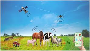
Learn how to use Google Earth Engine for geospatial analysis and map land suitability for optimal cattle farming site selection.
Understand how to integrate land cover, slope, temperature, precipitation, and water proximity data to identify optimal cattle farm locations.
Gain skills in creating, combining, and visualizing spatial masks to evaluate environmental factors affecting cattle farming suitability.
Export and interpret geospatial results to support data-driven decision-making for sustainable and optimal cattle farming site planning.
Requirements
No prior experience with Google Earth Engine is required - the course will guide you step-by-step.
Description
Are you interested in sustainable agriculture and geospatial technology? This course gives you the tools and knowledge to map and analyze optimal sites for cattle farming using remote sensing, GIS, and Google Earth Engine (GEE). Whether you are a student, farmer, environmental consultant, or GIS professional, you'll discover practical methods to evaluate land suitability and make better land-use decisions.We begin by demystifying the fundamentals of remote sensing-how satellites capture and deliver valuable environmental data that you can use to understand the land. You'll learn about sensors, spectral bands, and key principles needed to interpret imagery effectively.Next, we'll explore the concept of site suitability mapping. You'll discover how to define selection criteria-like land cover, slope, temperature, precipitation, and distance to water-and why each factor matters for successful cattle farming. We'll cover the basics of GIS, equipping you with essential spatial analysis skills.Once you understand these foundations, you'll dive into Google Earth Engine. This powerful cloud-based platform allows you to access massive datasets, process them at scale, and visualize results interactively. Step by step, you'll learn to code your suitability model, combine multiple environmental layers, and create clear maps that highlight optimal farming zones.By the end of this course, you will have built a complete cattle farm suitability workflow in GEE, gained confidence in remote sensing and GIS concepts, and developed a skill set you can apply to real-world projects in agriculture, land planning, or environmental management.Join today and start creating data-driven solutions for sustainable livestock farming!
Who this course is for
Students, researchers and professionals in agriculture, environmental science, geography, or remote sensing looking to apply satellite data in real-world scenarios.