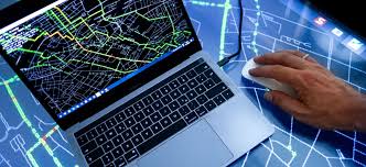
Geospatial Intelligence
Published 2/2026
MP4 | Video: h264, 1920x1080 | Audio: AAC, 44.1 KHz, 2 Ch
Language: English | Duration: 39m | Size: 718.7 MB
GIS and Location Intelligence tips and tricks
What you'll learn
Build professional Web GIS applications and interactive map dashboards using AI chatting-no manual coding required.
Connect AI models (Cursor/MCP) to real-time geospatial services for live traffic, routing, and location-based insights.
Use AI-driven machine learning techniques to detect buildings and roads from satellite imagery with limited training data.
Automate repetitive QGIS tasks using Python scripts, including loading 50+ basemaps in under 1 minute for faster project setup.
Requirements
A computer with an internet connection. Basic familiarity with QGIS is helpful but not mandatory. No prior programming experience is required (we use AI to handle the code). A desire to learn how AI and Python are transforming the geospatial industry.
Description
Elevate Your Career with Geo-AI Mastery
In the rapidly evolving world of 2026, standard GIS skills are no longer enough to stay competitive. The industry is shifting toward Geospatial Intelligence (Geo-AI)-a field that combines traditional geography with cutting-edge artificial intelligence and high-speed automation. This course, Learn_Geo_Intelligence, is designed by Mohamed Othman (MSc) to bridge that gap and turn you into a modern, tech-forward GIS professional.
Why this course?
Most GIS courses focus on manual clicks and outdated workflows. This masterclass focuses on Speed, Intelligence, and Automation. Whether you are an analyst looking to save hours of work or a developer wanting to build spatial apps, this curriculum provides the practical "hacks" used by industry experts.
What we will cover
• No-Code AI Mapping: Learn how to "chat" with AI to build fully functional Web GIS applications and interactive dashboards in minutes.
• The Model Context Protocol (MCP): Connect AI engines directly to real-time geospatial data for traffic, routing, and location-based insights.
• QGIS Automation with Python: Stop the manual grind. You will receive scripts that automate repetitive tasks, like loading dozens of basemaps instantly.
• Advanced AI Feature Extraction: Learn to detect roads and buildings from satellite images using limited data and machine learning.
Redefining the GIS Professional
The 2026 job market rewards those who can synthesize data, not just collect it. We dive deep into the Generative GIS revolution, showing you how to leverage Large Language Models (LLMs) to write complex SQL queries and Python geoprocessing scripts on the fly. You will move beyond being a "map maker" to becoming a Spatial Architect who can deploy automated pipelines that monitor environmental changes or urban growth in real-time.
Real-World Application & Strategic Growth
We don't just teach theory; we focus on Scalability. You will learn how to handle massive datasets-the kind that would crash standard desktop software-using cloud-integrated AI workflows. This course teaches you to build tools that think, helping you provide predictive insights rather than just historical snapshots.
What you get inside
By enrolling in this course, you aren't just getting video tutorials. You are getting access to a library of Python scripts, AI prompts, and sample datasets that you can use in your own professional projects today.
Join thousands of learners in the Geo-AI revolution. By the end of this course, you will have a portfolio of AI-powered mapping projects that demonstrate your ability to lead in the 2026 geospatial market. Considering the investment you've already made in your future-much like your long-term commitment to your new home-securing these high-income skills is the smartest move you can make this year. This is more than a course; it's an investment in your future as a leader in Geo-Intelligence.
Who this course is for
GIS Analysts and Specialists who want to automate their daily workflows. Data Scientists interested in the "Geo-Intelligence" niche. Students or MSc graduates looking for practical AI/Python applications in mapping. Professionals who want to build GIS tools quickly without being full-stack developers.